


INDEPENDENCE TWP Voting District, Jasper County, Iowa
About
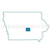
Outline

Summary
| Unique Area Identifier | 582435 |
| Name | INDEPENDENCE TWP Voting District |
| County | Jasper County |
| State | Iowa |
| Area (square miles) | 35.52 |
| Land Area (square miles) | 35.49 |
| Water Area (square miles) | 0.03 |
| % of Land Area | 99.92 |
| % of Water Area | 0.08 |
| Latitude of the Internal Point | 41.81267890 |
| Longtitude of the Internal Point | -93.17693550 |
Maps


Graphs
Select a template below for downloading or customizing gragh for INDEPENDENCE TWP Voting District, Jasper County, Iowa


Neighbors
Neighoring Voting District (by Name) Neighboring Voting District on the Map
- CLEAR CREEK TWP Voting District, Jasper County, IA
- COLLINS TWP Voting District, Story County, IA
- EDEN TWP Voting District, Marshall County, IA
- LOGAN TWP W/O MELBOURNE Voting District, Marshall County, IA
- MALAKA TWP Voting District, Jasper County, IA
- NEWTON TWP PART W/O LAMBS GROVE & NEWTON Voting District, Jasper County, IA
- POWESHIEK TWP Voting District, Jasper County, IA
- SHERMAN TWP Voting District, Jasper County, IA
Top 10 Neighboring County Subdivision (by Population) Neighboring County Subdivision on the Map
- Newton township, Jasper County, IA (15,576)
- Independence township, Jasper County, IA (1,684)
- Poweshiek township, Jasper County, IA (1,149)
- Logan township, Marshall County, IA (1,129)
- Collins township, Story County, IA (787)
- Eden township, Marshall County, IA (636)
- Sherman township, Jasper County, IA (406)
- Clear Creek township, Jasper County, IA (381)
- Malaka township, Jasper County, IA (313)
Top 10 Neighboring Place (by Population) Neighboring Place on the Map
Top 10 Neighboring Unified School District (by Population) Neighboring Unified School District on the Map
- Newton Community School District, IA (21,271)
- West Marshall Community School District, IA (4,766)
- Colfax-Mingo Community School District, IA (4,409)
- Collins-Maxwell Community School District, IA (2,751)
- Baxter Community School District, IA (1,899)
Top 10 Neighboring State Legislative District Lower Chamber (by Population) Neighboring State Legislative District Lower Chamber on the Map
- State House District 10, IA (30,112)
- State House District 41, IA (28,844)
- State House District 44, IA (27,889)
Top 10 Neighboring State Legislative District Upper Chamber (by Population) Neighboring State Legislative District Upper Chamber on the Map
- State Senate District 21, IA (65,772)
- State Senate District 22, IA (58,228)
- State Senate District 5, IA (57,426)
Top 10 Neighboring 111th Congressional District (by Population) Neighboring 111th Congressional District on the Map
Top 10 Neighboring Census Tract (by Population) Neighboring Census Tract on the Map
- Census Tract 102, Story County, IA (3,943)
- Census Tract 402, Jasper County, IA (3,924)
- Census Tract 9503, Marshall County, IA (3,443)
Top 10 Neighboring 5-Digit ZIP Code Tabulation Area (by Population) Neighboring 5-Digit ZIP Code Tabulation Area on the Map
- 50208, IA (20,417)
- 50028, IA (1,681)
- 50162, IA (1,233)
- 50055, IA (913)
- 50168, IA (842)
- 50234, IA (613)
- 50127, IA (29)